

Millions of people in Indonesia, a vast low-lying archipelago in Southeast Asia with the second-longest coastline in the world, live in flood-prone river and coastal areas. Floods and storms are the most common type of disaster affecting Indonesian cities, according to a UN report.
Current attempts to manage these disasters rely heavily on investing in flood walls and canals. These measures seem to be insufficient, as the disasters continue every year, hurting the economy.
Our latest research shows citizen science can contribute to finding solutions by helping scientists understand the impacts of floods.
Citizen science is a way for communities to collaborate with researchers. This approach has been gaining traction in fields such as ecology, environmental planning and hydrology.
Engaging with community
After reviewing 40 publications from the past five years, we found scientists have been increasingly interested in involving communities in flood studies.
In Australia, for example, scientists analysed photos posted on social media during the 2010 Queensland floods to map water levels. Similarly, scientists in Argentina used community measurements from the 2014 Buenos Aires floods to model the local hydrology.
Most of these projects, however, only involve citizens as data collectors. They offer limited opportunities for scientists to work closely with, and learn from, communities.
Read more: RISE Indonesia: Revitalising informal settlements in Makassar
Some examples show communities can participate more directly as interpreters and central stakeholders in the process of understanding, managing, and responding to floods.
In Indonesia, for example, the PetaBencana project is a phone application that allows citizens to contribute to flood studies by sharing information about water levels. This information is available to other users, and can inform emergency services and government activities.
This example shows that the application of citizen science to study floods, beyond collecting data, can help risk communication and involve these communities in technical discussions.
Learning from Makassar
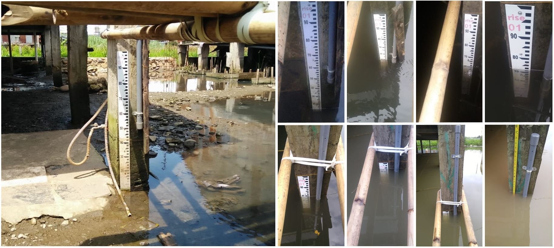
In Makassar, South Sulawesi, Indonesia, we partnered with community members to collect photos of floods throughout the past two years.
This citizen science project was developed as part of the Revitalising Informal Settlements and their Environments (RISE) program. The program is testing innovative infrastructure systems in 12 settlements in Makassar and 12 settlements in Fiji.
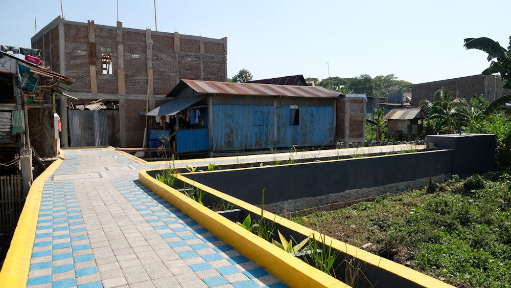
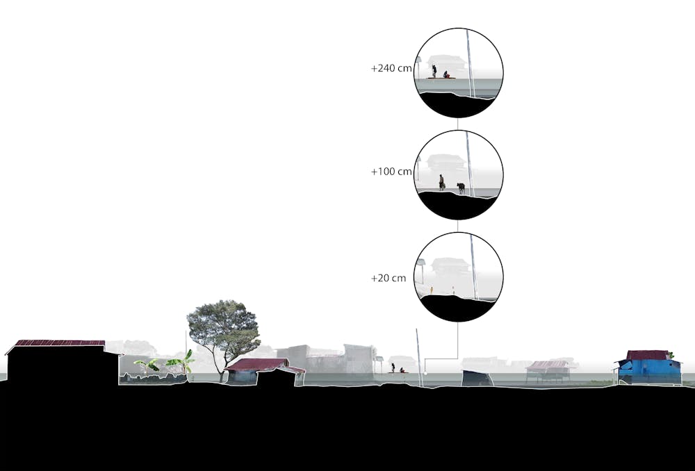
The designers in RISE soon realised that understanding floods in particular sites was essential to ensure the infrastructure would work well.
Partnering with volunteers from six settlements in Makassar, RISE has documented floods throughout the rainy seasons of 2018, 2019 and 2020.
So far, it’s received more than 2800 photos from local communities in Makassar. These images have allowed scientists to better understand floods, and design more resilient infrastructure.
The experiences of RISE and other citizen science initiatives indicate this kind of project can positively transform the relationship between scientists and communities.
Beyond supporting data collection, citizen science allows researchers to work more directly with communities while creating opportunities for science to connect with local knowledge and adaptation strategies.
It’s important to highlight that communities should not be held responsible for managing floods alone. Citizen science is not a substitute but a complement to evidence-based policy and infrastructure planning.
Local wisdom
On the peripheries of the largest Indonesian cities, the residents of kampungs and informal settlements close to canals and rivers rely on local wisdom to coexist with floods.
Our research shows the residents of kampungs in Makassar often work with neighbours to protect valuable assets or to evacuate the elderly and the children.
They have also developed important strategies to protect their houses, such as using sandbags and building on stilts.
How can scientists learn from them?
Access to the internet and social media has shown people can collect information about floods, but the example from the RISE program shows how this can be done by connecting scientists and local communities.
The long-term effects of the project are still being studied, but participants have told us RISE’s citizen science project helped them better-understand floods in their neighbourhoods. It also provided a platform for them to share experiences and knowledge.
While we’re still learning how scientists can work with communities, the lessons from the RISE program show citizen science can be a powerful ally in building resilience and supporting local knowledge and agency in Indonesian cities.
The article was made possible due to contributions from the RISE program’s researchers and staff members, as well as volunteers.

Erich Wolff is currently developing his doctoral studies within the RISE program, and receiving a scholarship from Monash University.
Diego Ramirez-Lovering is Professor of Architecture at Monash University, and part of the executive team for the RISE Program.
This article originally appeared on The Conversation.


