

Once upon a time in Melbourne, a large saltwater wetland sat at the northern tip of Port Phillip Bay, fed by the Moonee Ponds Creek and the Yarra River flood tide. It teemed with birds and fish, and Aboriginal people from both sides of the bay chose to meet there. It was “a real lake, intensely blue, nearly oval and full of the clearest salt water”, wrote early settler George McCrae.
As Melbourne grew, the wetland divided the new city, making it difficult to cross from east to west, particularly after heavy rains. The West Melbourne Swamp (or Batman’s Swamp as it was also known) became foul, and was eventually drained by well-meaning engineers. During the Great Depression of the 1930s, a notorious shanty town known as the Dudley Flats sprawled on the swamp’s edge.
The swamp’s last vestiges, on the north side of South Kensington Railway Station, were finally eliminated in the 1950s. In his autobiography, Paper Chase, the writer Hal Porter described the site as “no man’s land”.
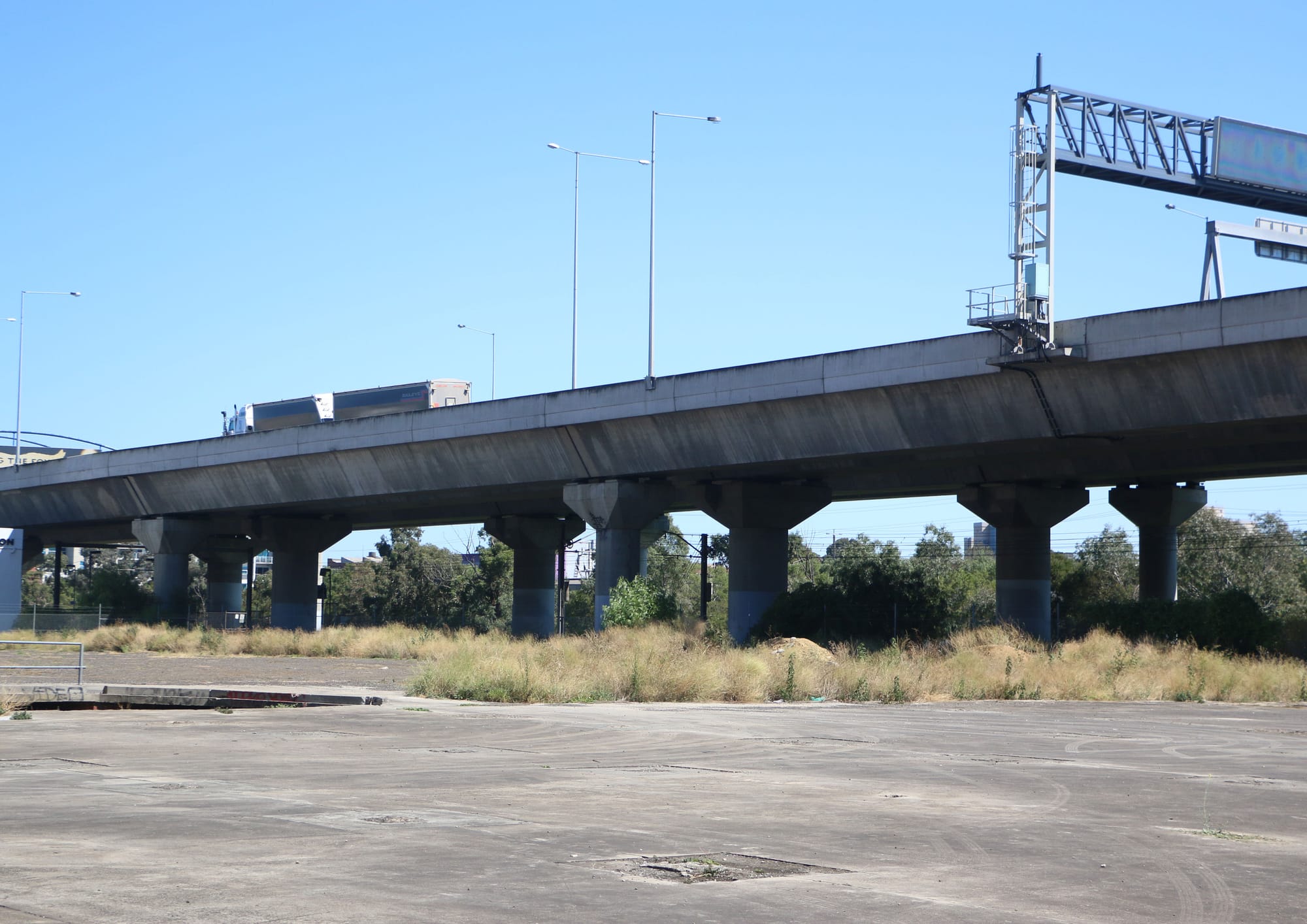
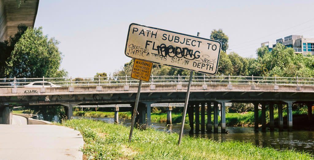
Sixty years later, a no-man’s-land of sorts still exists south of the old swamp, in the area between South Kensington and North Melbourne stations. The area includes Macaulay Railway Station, which lies beneath the CityLink flyover, and the Moonee Ponds Creek, which runs under the Tullamarine Freeway in a concrete channel. (The creek was once a series of ponds that joined up and flowed into the swamp during rainy periods.)
“It’s quite easy to feel disoriented there,” says Nigel Bertram, practice professor of architecture at Monash Art Design and Architecture (MADA). “The grid system of Melbourne breaks down in part because of the previous water bodies. There are roads that go through, but you don’t get a sense of clear, multi-directional openness. There’s congestion at this point because of different systems overlapping and hitting each other. It’s a bit of a bottleneck.”
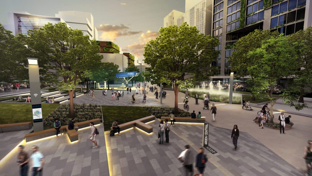
The area has been earmarked for future development – the vision is for knowledge industries and residential towers to rise in the region between the old swamp and the bay. The catalyst for renewal will be the Arden Metro Railway Station that’s being constructed on Laurens Street, between Queensberry and Arden streets. The new station will provide a link to Parkville, Melbourne University and the biomedical precinct.
“It’s a part of Melbourne that will transform,” Professor Bertram says. “Because of the Moonee Ponds Creek interface, the need to address flooding issues, the area’s proximity to the city centre – although historically it wasn’t a very desirable part of town. There’s a lot of industry that’s turning over, which in one sense is an opportunity.”
With MADA researcher Catherine Murphy, Professor Bertram has been working with MADA students and imagining how this site can be redeveloped while also respecting – and allowing for – its watery origins. The precinct has been dubbed Arden-Macaulay – a designation that encompasses a patchwork of government land, industrial buildings, social housing and historic streets.
The Arden-Macaulay project is part of the Co-operative Research Centre for Water Sensitive Cities (CRCWSC). The centre is driving interdisciplinary research into urban planning and water management in Australia and overseas. In an era of climate change, it defines a water-sensitive city as one that protects the health of its waterways and wetlands, mitigates flood risk, and provides water security by recycling and collecting water.
In the years ahead, waterfront cities around the world will be forced to adapt to sea level rises, and Melbourne is particularly vulnerable.
Port Phillip Bay and Western Port Bay are what is known in geomorphology as a ‘sunkland’ – a depressed zone between two faultlines, one in Bacchus Marsh and the other in Drouin, says Professor Bertram. “Such a broad, sunken environment is very susceptible to changes in sea level due to its flatness.”
Various authorities, including Melbourne Water and the Victorian Planning Authority, are planning for the future Arden-Macaulay precinct. “These different bodies are understandably concerned with managing their particular part of the jigsaw,” says Murphy. “Our project is about trying to put the pieces together in a different way.”
City planners can take “a negative or a positive approach” to the challenges posed by the site, says Professor Bertram. “You could say negatively that you can’t use normal building techniques there, or if you do it will be a very substandard environment. For example, it’s very expensive to build a basement in the silty soil there, with all sorts of waterproofing issues.”
Southbank and Fishermen’s Bend (an urban renewal precinct south of the Melbourne city centre) have similar limitations. At Southbank, developers have responded by building above-ground multi-level carparks below high-rise towers, an ugly fix that deadens the streetscape.
On the other hand, Arden-Macaulay could be seen as a rare opportunity to recreate a wetland near the city centre, he says.
“This is a chance for Melbourne to redevelop an area that has a totally different character; that really embraces its water environment, and uses the development to redefine and rejuvenate the destructive acts that have happened to these half-wet, half-dry environments.”
MADA’s creative responses to these challenges can be seen in Arden-Macaulay in Transition – Four adaptive design concepts for drainage and flood management. The document explores how the area might be developed if the water that naturally flows into the site was not hidden or drained away. The work was informed by research into the history of swamps and wetlands in Port Phillip, and by responses to design workshops that were attended by members of local government authorities, water companies and government planners.
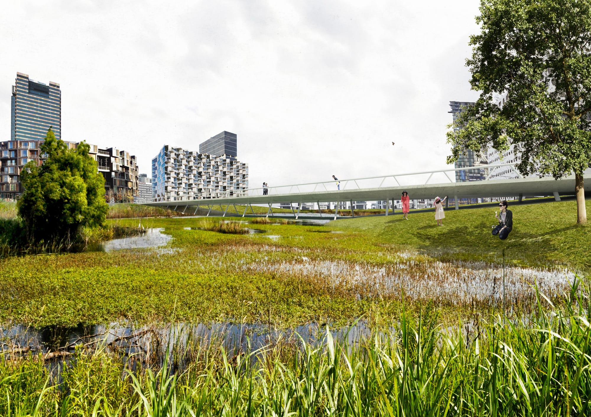
MADA’s proposals are bold and inspiring. One calls for a series of large ponds or retention basins to be constructed that, in Professor Bertram’s words, “allow for the flooding and spill into each other”. The basins would have “different degrees of saltiness, so the gradation between fresh water and salt water might be more subtle and able to be regulated … Different plants, different ecosystems could develop around the ponds, which is more like a natural condition where you have stages of intertidal quality.”
Another calls for “islands” to be created throughout the site, connected by bridges, with the water flowing (intermittently) between them, like a braided stream. The new metro station would stand on one island, others would be connected by boardwalks and bike paths.
“This is a chance for Melbourne to redevelop an area that has a totally different character; that really embraces its water environment, and uses the development to redefine and rejuvenate the destructive acts that have happened to these half-wet, half-dry environments.”
A third possibility is for part of the old West Melbourne swamp to be recreated and for the old form of the creek to be duplicated “through a series of storage basins, channels and pipes”, fed by water collected from the creek, from buildings and street run-off. The man-made ponds would be dry in drought, while in times of flood they could overflow into the bay via a spillway.
The MADA proposals are being put forward at an interesting time. Melbourne has already seen what can happen when centrally located land is developed without state-funded planning and investment – windswept Docklands is the underwhelming result. “The state didn’t invest adequately up front and lead the process,” Professor Bertram says. “They gave all the risk to the market and expected developers to lead. And that’s been shown around the world to be an anomaly.”
And last month, the State Government placed a hold on 26 high-rise towers at Fishermen’s Bend until permanent planning controls are in place – a sign that it’s wary of repeating the mistakes made at Docklands.
Before working on the Arden-Macauley project, Professor Bertram and Murphy worked on another CRCWSC water project in Elwood, a bayside suburb that’s prone to flooding and sensitive to sea-level rises. The Elwood canal was created by the engineer Carlo Catani. He also drained the great Koo-Wee-Rup Swamp, and was considered a visionary in his day. In the Elwood project, they learned about the wetlands that once dotted the sandbelt, and how vulnerable the rim of Port Phillip Bay, and the million or so people who live along it, will be to the rising tide.
Professor Bertram says the question for Arden-Macaulay – and for bayside Melbourne generally – is, how can planners “respond more deeply to those swampy, intertidal conditions” that once characterised the Port Phillip region, over the next 100 to 200 years?
MADA’s plans for Arden-Macaulay respond specifically to the requirements of an industrial, inner urban site. The hope is that the work will not only initiate a conversation about how to prepare for the opening of a new railway station, but that it will encourage planners to think more broadly and deeply about how the city can respond to challenges in the next generation and beyond.
“For this project we tried to project 50 years into the future, which is far enough away to imagine something has happened,” says Professor Bertram. “It’s not tomorrow. The rules might be different then. And you can easily imagine a dystopian future, or a utopian one – our task is to try to achieve the latter.”


